GeoCompanion
Applications
Products
Use Cases
Company
Contact
Home > Applications
GSM/GPRS and Iridium satellite tracking
Keep track of your workforce, teams, clients, vehicles, and high-value assets using modern GSM/GPRS or Iridium satellite network tracking technology. Customers can choose between iOS devices (iPhone, iPad and iPad Mini), GPRS hand-held tracker, GPRS vehicle tracking terminals, satellite hand-held tracking devices or satellite/GSM hybrid tracking devices.
Our client and employee tracking solution is fully compliant with HSE requirements, allowing users to simply turn off the application or a device and therefor not transmitting any data to your server.
Stationary global monitoring
Enable your security managers to monitor the journey progress and status of your global workforce from a static or mobile location. In most use cases all assets are monitored from a stationary operation room. The Ops Room application can be operated on many screens enabling your personnel to monitor single assets or teams. The Pro app allows your team leaders, Ops managers and security managers to monitor in real-time all assets using their corporate iPad / iPad Mini with Internet access. The Pro app is optimized for low-bandwidth environment.
Mobile global monitoring
Enable your in-field personnel to share location information with other field personnel in real-time to coordinate movements and immediate actions if required (road traffic accident). Field personnel can share: Location reports, emergencies, geofencing, heading, and other location information.
Besides monitoring, in-field personnel can communicate directly without coordinating via a central command center (HQ).
Messaging and information exchange
Messaging is an integral part of the GeoC platform. It allows the exchange of information such as messages, news updates, location-based information, situational updates, and journey status reports between users. The messaging interface of the Ops Room software and the native iOS applications is user friendly and allows the rapid exchange of information.
Online satellite imagery and
on-demand imagery
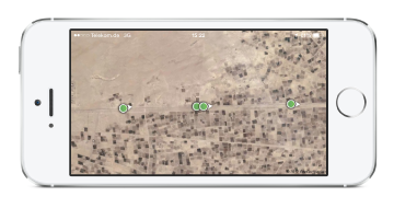
GeoC offers unique and unparalleled mapping features. All users (PC/Mac and iOS devices) have access to high-quality satellite imagery, street-level maps, terrain maps and online geographical overlays. Additionally, GeoCompanion provides up-to-date satellite imagery of specific areas of interest upon customers' request. We can task satellites to acquire any imagery your project, client or Ops Room requires. On-demand imagery is instantly available to Ops Room and GeoC Pro users.
Offline mission-critical mapping
For Ops Rooms and iPad or iPhone users GeoCompanion provides mission-critical offline maps of Afghanistan, Libya, Nigeria, Iraq, Pakistan, Syria and Yemen. Mission-critical maps are used as reliable mapping source by governments, international organizations, and business travelers.
GIS map data is provided by our mapping partner LeadDog Consulting LLC. If your specific area of interest is not covered, we update the map to suit your requirements.
Comprehensive geographical database
The geographical database is one of the strongest advantages of the GeoC platform. Whereas before corporations used to maintain isolated geographical database on many desktop computers, GeoC provides a single, unified and shareable database. Geographical information is provided to all teams and Ops Rooms and updates automatically on all devices.
In-field personnel can create geographical information and share it with your Ops Room or any other specified in-field user.
Geographical overlays
Depending on your project, country of use or area of interest your Ops Room can create geographical map overlays for presentational purposes including MGRS grids, oil fields, provinces, districts, routes, weather information or locations of ethnic, religious or social groups.
The overlays are instantly served to all in-field personnel and other Ops Rooms.
Emergency and alerts
The GeoC platform provides extensive emergency and alert notifications. Emergencies triggered by users are delivered within seconds to your Ops Room and other authorized users.
Geofencing alerts can be configured individually and are triggered automatically by the devices or the Ops Room depending on the scenario.
Administration and project management
The GeoC platform supports multiple Ops Rooms, shared views, restricted asset visibility, granular right management, restriction of access and many more features to meet your security and organizational requirements.
Services
Accessory
© 2014 Copyright GeoCompanion.
All Rights Reserved.
© 2014 Map data by Mapbox, Openstreetmap, DigitalGlobe